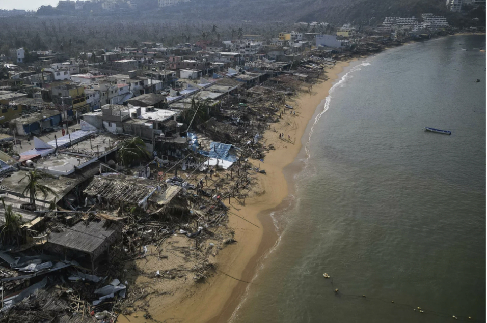
Hurricane Otis approached Acapulco, Mexico on Oct. 24 at an intensity that early weather forecasters didn’t anticipate. Forecasters had predicted the hurricane would reach land as a normal tropical rainstorm. A usual occurrence for this area of the world since storms are prevalent during this season.
However, in just under 24 hours, the winds gained 110 mph of strength. This turned the rainstorm into a Category Five hurricane. This surpassed Hurricane Patricia, which occurred in 2015, for the fastest wind speed of a hurricane that had ever reached land.
“On Monday night, most computer models only simulated Otis’s top winds reaching 60 mph,” (The Washington Post). I think this is where forecasters made a fatal mistake. The hurricane warning changed from a tropical storm to a Category One hurricane, and then to a Category Four hurricane only 12 hours before landfall. If they had looked at the hurricane’s path closer, I think they could’ve predicted this intensification more accurately. Preventing the chaos that followed.
As the death toll and the number of missing people rose, a scramble began. People began looting from stores and ATMs. The lines for food and water for humanitarian aid stretched down the road. A panic that could’ve been predicted and avoided if the hurricane had been accurately assessed.
This rapid intensification shocked forecasters, an inaccuracy of wind speeds in excess of 100 mph is highly irregular. Climate change is partially to blame for it. “2023 saw abnormally high surface temperatures in the ocean. Otis, for example, passed through 88 degree surface waters before slamming into Mexico,” (CBS News).
As the climate warms, the predictability of how storms will intensify will falter. Forecasters should note that this phenomenon will only increase over time alongside the climate. They were misled by this hurricane, but they might have better gauging for future ones. They just need to analyze its path more closely.


